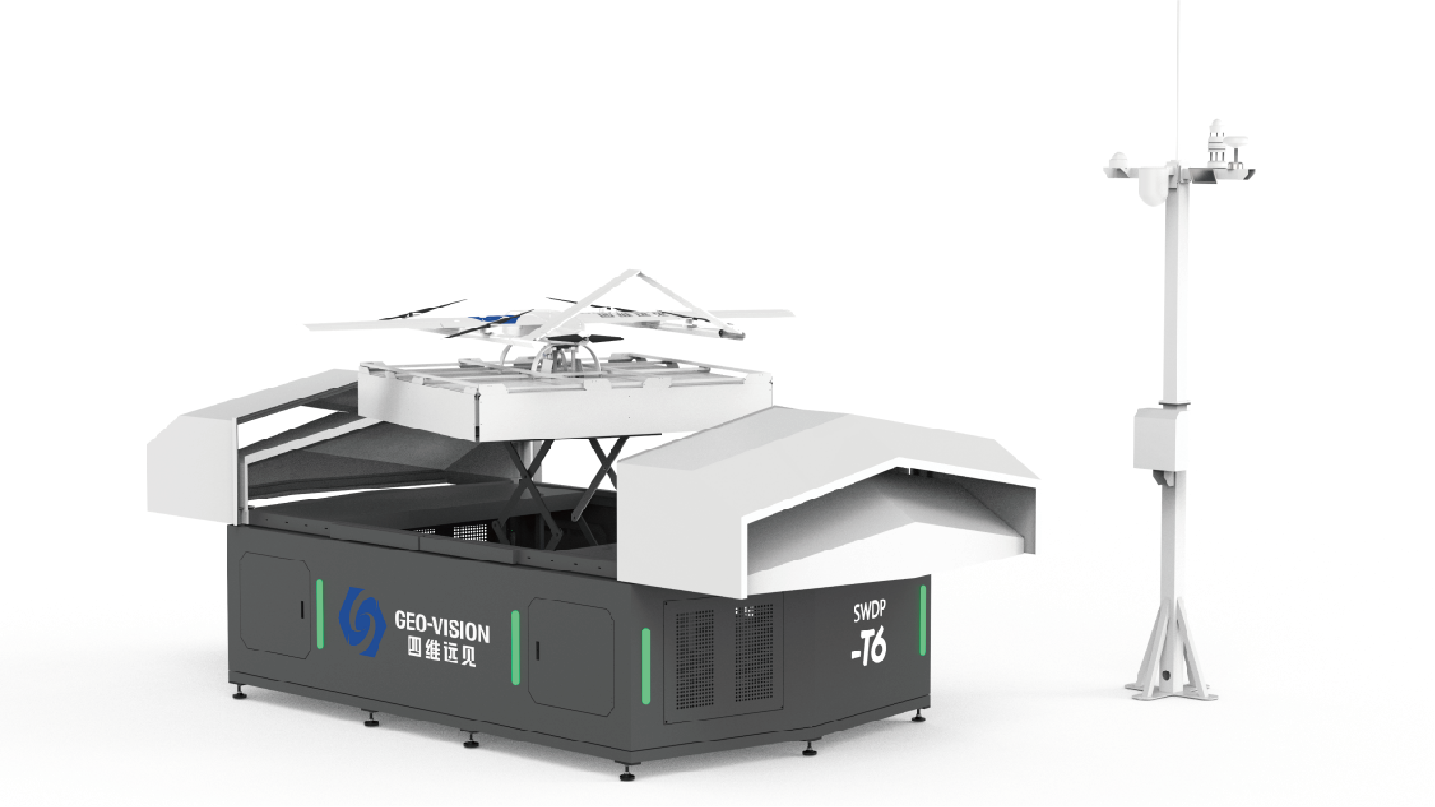
SWDP-T6 vertical take-off and landing fixed-wing unmanned airport carries the DP-20V high-performance drone, featuring an ultra-long endurance of 2.5 hours and a control range of 50 kilometers. It integrates a high-definition zoom camera, thermal imager, and laser rangefinder into a three-sensor gimbal, along with a large-format aerial survey camera. One platform offers multiple functions, achieving extremely high operational efficiency. Combined with a self-developed cloud management platform, it enables a one-stop closed loop from intelligent planning and automatic execution to data return and processing, ushering in a fully automated and highly efficient 'Drone Inspection 2.0 Era.'
Product Highlights:
· Safe and Reliable, Automatic Standby
Professional automated airport design ensures safe all-weather standby, with stable and reliable operation.
· Lightweight and Easy to Deploy
Compact and lightweight, convenient for transportation and rapid deployment with strong mobility. Storage dimensions: 3800mm × 2300mm × 1750mm
Deployed dimensions: 5400mm × 2300mm × 1750mm
· Fully Automated Process
Automatic Charging: 220V power supply, up to 30A fast charging, BMS intelligent management, constant temperature and humidity environment, prolonging equipment life.
Automatic Take-off and Landing: RTK visual assistance, centimeter-level precision positioning, UPS power backup ≥4 hours, multiple safety protections.
Automatic Data Return: 275T edge computing power, second-level data acquisition and analysis, transmitting only high-value data to improve processing efficiency.
· Comprehensive Three-Dimensional Monitoring
Integrated multi-functional base station for navigation, communication, and atmospheric monitoring, with internal and external cameras and meteorological sensors. Combined with real-time drone footage, it enables full-area 3D surveillance.
· Three-Sensor Gimbal for Multi-Functional Sensing
The DP-20V features a three-axis stabilized gimbal with three sensors, combining a 40x optical zoom camera, 640×512 thermal imaging, and a 3000m laser rangefinder. Supports intelligent tracking and AI recognition, with strong target identification capabilities.
· Efficient Aerial Surveying, Multiple Functions in One
Large-format aerial survey camera for higher operational efficiency; supports modular replacement with six-lens oblique camera, LiDAR, and AI camera modules to adapt to multiple operational scenarios.
· Intelligent Cloud Management Platform
Integrates flight route planning, dispatch command, data visualization, analysis and storage, and device management. Accessible via WEB interface, supports local/cloud deployment, strong compatibility, and can interface with mainstream drones and airport equipment.